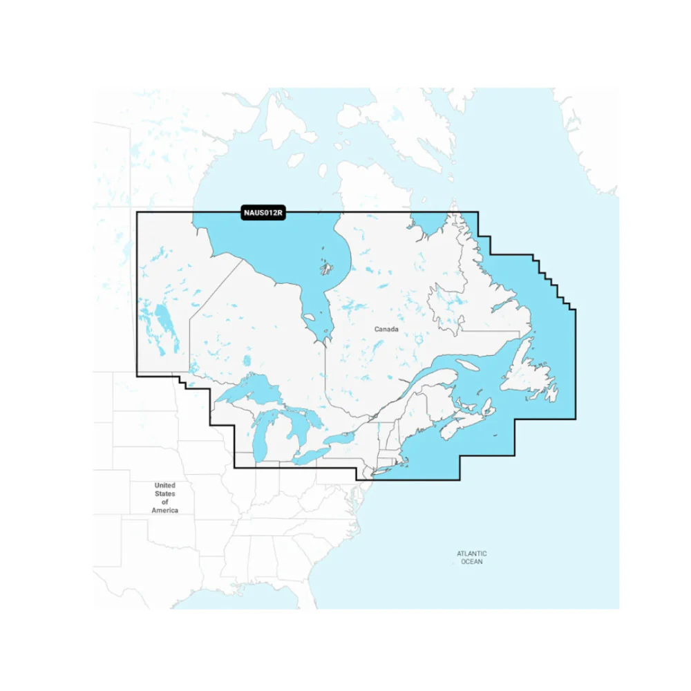
Navionics NAUS012R - Canada, East & Great Lakes - Navionics+
A comprehensive, all-in-one solution, Navionics+ charts and maps combine clear, reliable coastal/inland content with advanced guidance features and compatibility with a wide range of chartplotter brands.
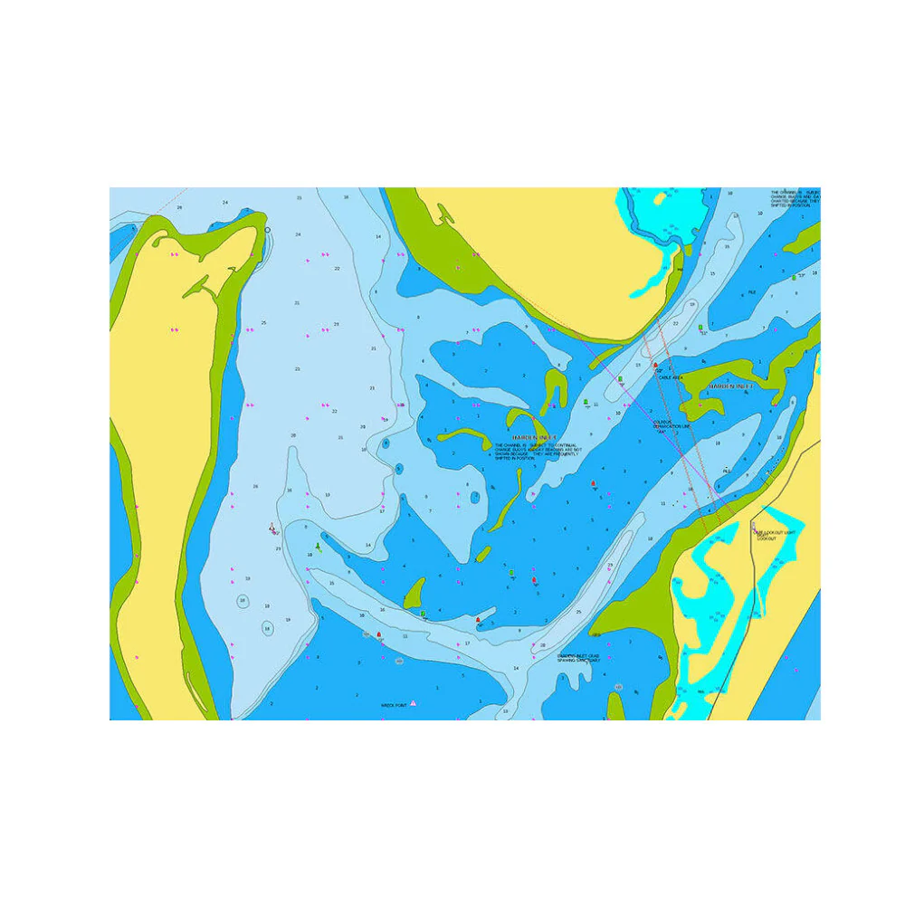
All-in-One Mapping Solution
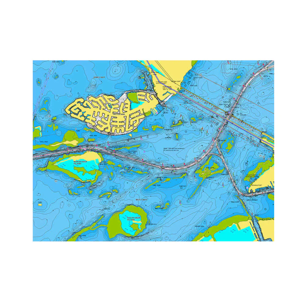
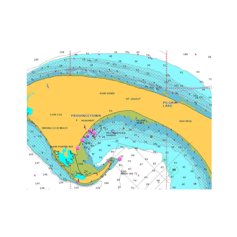
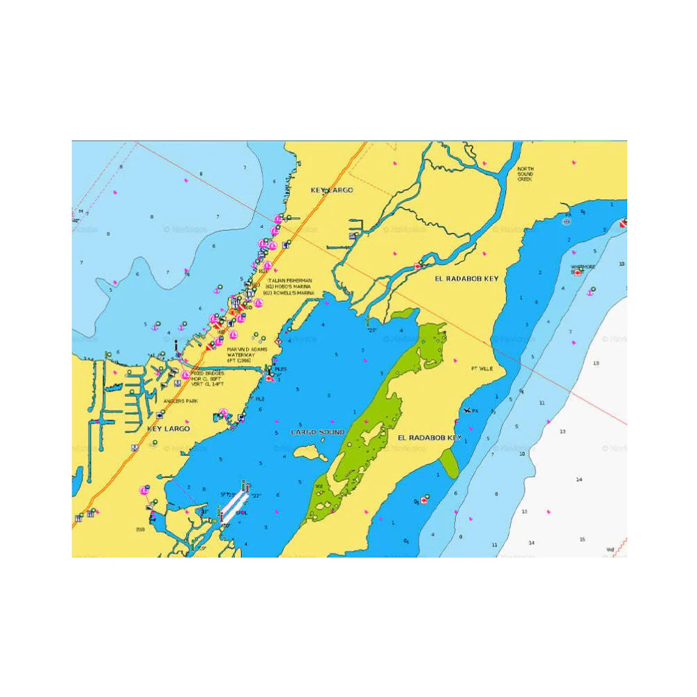
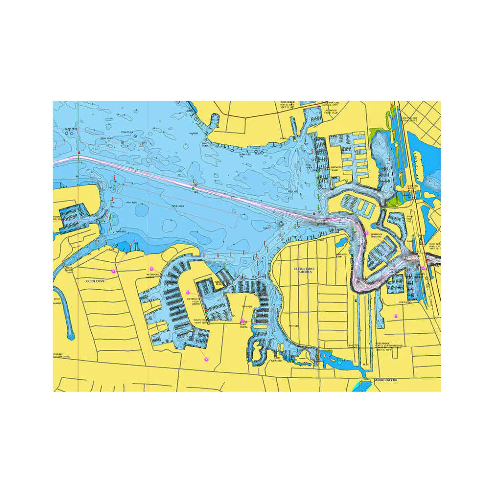
Access detailed charts of coastal waters, lakes, rivers, harbors, and marinas compatible with a wide range of chartplotters. Integrated coastal and inland lake content offers coverage for boaters worldwide.
Daily Chart Updates
1-year subscription provides access to daily updates via Navionics chart installer software, keeping maps current and accurate.
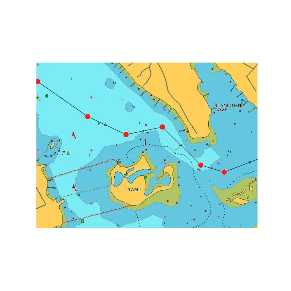
Dock-to-Dock Route Guidance
Advanced routing calculates optimal paths from dock to dock using your boat settings, chart data, and popular travel routes.
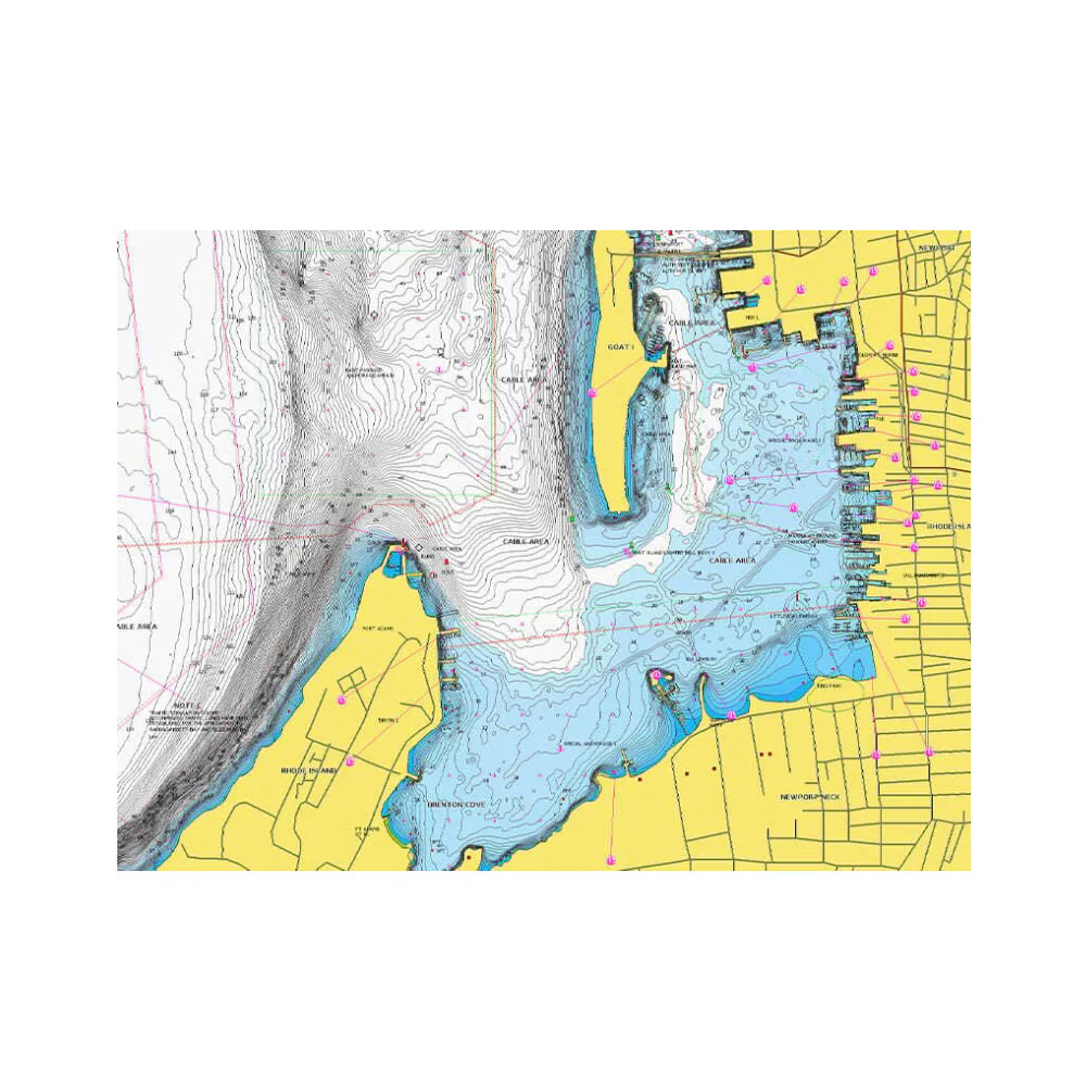
High-Resolution Mapping & Contours
Up to 1-foot contours, sonar imagery, and relief shading enhance navigation and fishing by clearly depicting bottom structures.
3D, Satellite & Aerial Views
SonarChart Live, high-resolution satellite imagery, aerial photography, and 3D views offer full situational awareness above and below the water.
Community Edits
Access useful local knowledge added by Navionics Boating app users and view the shared data directly on your compatible chartplotter.
Plotter Sync
Wirelessly transfer routes and markers, update charts, renew subscriptions, and upload sonar logs between your mobile app and plotter card.
Customizable Map Options
Highlight shallow areas, adjust contour density, or select fishing ranges to tailor maps to your needs.
More Images
Navionics NAUS012R - Canada, East & Great Lakes - Navionics+
A comprehensive, all-in-one solution, Navionics+ charts and maps combine clear, reliable coastal/inland content with advanced guidance features and compatibility with a wide range of chartplotter brands.
All-in-One Mapping Solution
Access detailed charts of coastal waters, lakes, rivers, harbors, and marinas compatible with a wide range of chartplotters. Integrated coastal and inland lake content offers coverage for boaters worldwide.
Daily Chart Updates
1-year subscription provides access to daily updates via Navionics chart installer software, keeping maps current and accurate.
Dock-to-Dock Route Guidance
Advanced routing calculates optimal paths from dock to dock using your boat settings, chart data, and popular travel routes.
High-Resolution Mapping & Contours
Up to 1-foot contours, sonar imagery, and relief shading enhance navigation and fishing by clearly depicting bottom structures.
3D, Satellite & Aerial Views
SonarChart Live, high-resolution satellite imagery, aerial photography, and 3D views offer full situational awareness above and below the water.
Community Edits
Access useful local knowledge added by Navionics Boating app users and view the shared data directly on your compatible chartplotter.
Plotter Sync
Wirelessly transfer routes and markers, update charts, renew subscriptions, and upload sonar logs between your mobile app and plotter card.
Customizable Map Options
Highlight shallow areas, adjust contour density, or select fishing ranges to tailor maps to your needs.
Product Information
Product Information
Shipping & Returns
Shipping & Returns
Description
A comprehensive, all-in-one solution, Navionics+ charts and maps combine clear, reliable coastal/inland content with advanced guidance features and compatibility with a wide range of chartplotter brands.
All-in-One Mapping Solution
Access detailed charts of coastal waters, lakes, rivers, harbors, and marinas compatible with a wide range of chartplotters. Integrated coastal and inland lake content offers coverage for boaters worldwide.
Daily Chart Updates
1-year subscription provides access to daily updates via Navionics chart installer software, keeping maps current and accurate.
Dock-to-Dock Route Guidance
Advanced routing calculates optimal paths from dock to dock using your boat settings, chart data, and popular travel routes.
High-Resolution Mapping & Contours
Up to 1-foot contours, sonar imagery, and relief shading enhance navigation and fishing by clearly depicting bottom structures.
3D, Satellite & Aerial Views
SonarChart Live, high-resolution satellite imagery, aerial photography, and 3D views offer full situational awareness above and below the water.
Community Edits
Access useful local knowledge added by Navionics Boating app users and view the shared data directly on your compatible chartplotter.
Plotter Sync
Wirelessly transfer routes and markers, update charts, renew subscriptions, and upload sonar logs between your mobile app and plotter card.
Customizable Map Options
Highlight shallow areas, adjust contour density, or select fishing ranges to tailor maps to your needs.