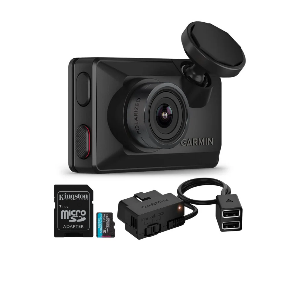
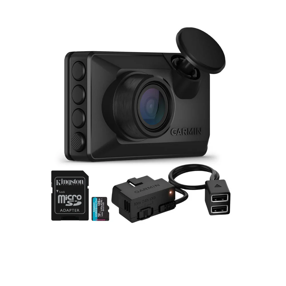
Navionics Platinum+ NPUS006R U.S. South Marine Navigation Chart
Get reliable and detailed marine mapping with the NPUS006R – U.S. South Platinum+ charts. Designed for offshore and inland waters, this chart package delivers comprehensive coverage and advanced navigation features for safer and easier boating.
Comprehensive Nautical Charts
Access detailed charts for lakes, rivers, and coasts across 13 U.S. states, including coastal coverage of the Gulf of Mexico, Florida Keys, Bahamas, and Atlantic coasts of Florida and Georgia. Charts are derived from official and private sources for accurate navigation.
HD Bathymetry and Sonar Features
Benefit from SonarChart 1’ (0.5 m) HD bathymetry maps that reveal underwater terrain in detail. With SonarChart Live, new HD depth maps build in real-time as you travel, helping identify structure and fishing spots.
Daily Updates and Community Edits
Stay up to date with up to 5,000 daily updates through the Navionics Chart Installer software. Community edits also provide shared knowledge, including local navigation details and fishing tips.
Dock-to-Dock Route Guidance
Plan trips more easily with route suggestions through channels, inlets, and marina entrances. Dock-to-dock guidance simplifies navigation and enhances safety.
Advanced Map Options
Customize maps with multiple shading options, relief shading, and target depth ranges. Satellite imagery, 3D perspective view, sonar imagery, and aerial photos provide enhanced situational awareness.
Plotter Sync and Connectivity
Sync routes, markers, and chart updates wirelessly between compatible chartplotters and the Navionics Boating app, ensuring consistent access to the freshest data.
More Images


Navionics Platinum+ NPUS006R U.S. South Marine Navigation Chart
Get reliable and detailed marine mapping with the NPUS006R – U.S. South Platinum+ charts. Designed for offshore and inland waters, this chart package delivers comprehensive coverage and advanced navigation features for safer and easier boating.
Comprehensive Nautical Charts
Access detailed charts for lakes, rivers, and coasts across 13 U.S. states, including coastal coverage of the Gulf of Mexico, Florida Keys, Bahamas, and Atlantic coasts of Florida and Georgia. Charts are derived from official and private sources for accurate navigation.
HD Bathymetry and Sonar Features
Benefit from SonarChart 1’ (0.5 m) HD bathymetry maps that reveal underwater terrain in detail. With SonarChart Live, new HD depth maps build in real-time as you travel, helping identify structure and fishing spots.
Daily Updates and Community Edits
Stay up to date with up to 5,000 daily updates through the Navionics Chart Installer software. Community edits also provide shared knowledge, including local navigation details and fishing tips.
Dock-to-Dock Route Guidance
Plan trips more easily with route suggestions through channels, inlets, and marina entrances. Dock-to-dock guidance simplifies navigation and enhances safety.
Advanced Map Options
Customize maps with multiple shading options, relief shading, and target depth ranges. Satellite imagery, 3D perspective view, sonar imagery, and aerial photos provide enhanced situational awareness.
Plotter Sync and Connectivity
Sync routes, markers, and chart updates wirelessly between compatible chartplotters and the Navionics Boating app, ensuring consistent access to the freshest data.
Product Information
Product Information
Shipping & Returns
Shipping & Returns
Description
Get reliable and detailed marine mapping with the NPUS006R – U.S. South Platinum+ charts. Designed for offshore and inland waters, this chart package delivers comprehensive coverage and advanced navigation features for safer and easier boating.
Comprehensive Nautical Charts
Access detailed charts for lakes, rivers, and coasts across 13 U.S. states, including coastal coverage of the Gulf of Mexico, Florida Keys, Bahamas, and Atlantic coasts of Florida and Georgia. Charts are derived from official and private sources for accurate navigation.
HD Bathymetry and Sonar Features
Benefit from SonarChart 1’ (0.5 m) HD bathymetry maps that reveal underwater terrain in detail. With SonarChart Live, new HD depth maps build in real-time as you travel, helping identify structure and fishing spots.
Daily Updates and Community Edits
Stay up to date with up to 5,000 daily updates through the Navionics Chart Installer software. Community edits also provide shared knowledge, including local navigation details and fishing tips.
Dock-to-Dock Route Guidance
Plan trips more easily with route suggestions through channels, inlets, and marina entrances. Dock-to-dock guidance simplifies navigation and enhances safety.
Advanced Map Options
Customize maps with multiple shading options, relief shading, and target depth ranges. Satellite imagery, 3D perspective view, sonar imagery, and aerial photos provide enhanced situational awareness.
Plotter Sync and Connectivity
Sync routes, markers, and chart updates wirelessly between compatible chartplotters and the Navionics Boating app, ensuring consistent access to the freshest data.