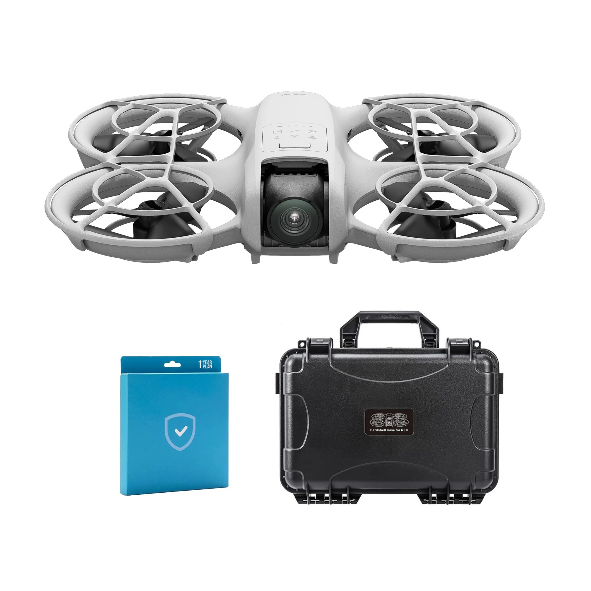
DJI Zenmuse L2 with DJI Care Enterprise Plus High-Precision Aerial LiDAR System
The DJI Zenmuse L2 is a high-precision aerial LiDAR system designed for fast, reliable, and accurate geospatial data collection. It combines a frame-based LiDAR, a self-developed high-accuracy IMU system, and an integrated 4/3 CMOS RGB mapping camera, providing superior performance for DJI flight platforms. Optimized for use with DJI Terra, the Zenmuse L2 delivers a complete solution for 3D data acquisition and high-accuracy post-processing. Ideal for professional mapping and surveying applications, this system ensures efficiency, precision, and reliability in every flight. DJI Enterprise Care Plus offers comprehensive protection against accidental damage, including collisions, water exposure, and misoperation.
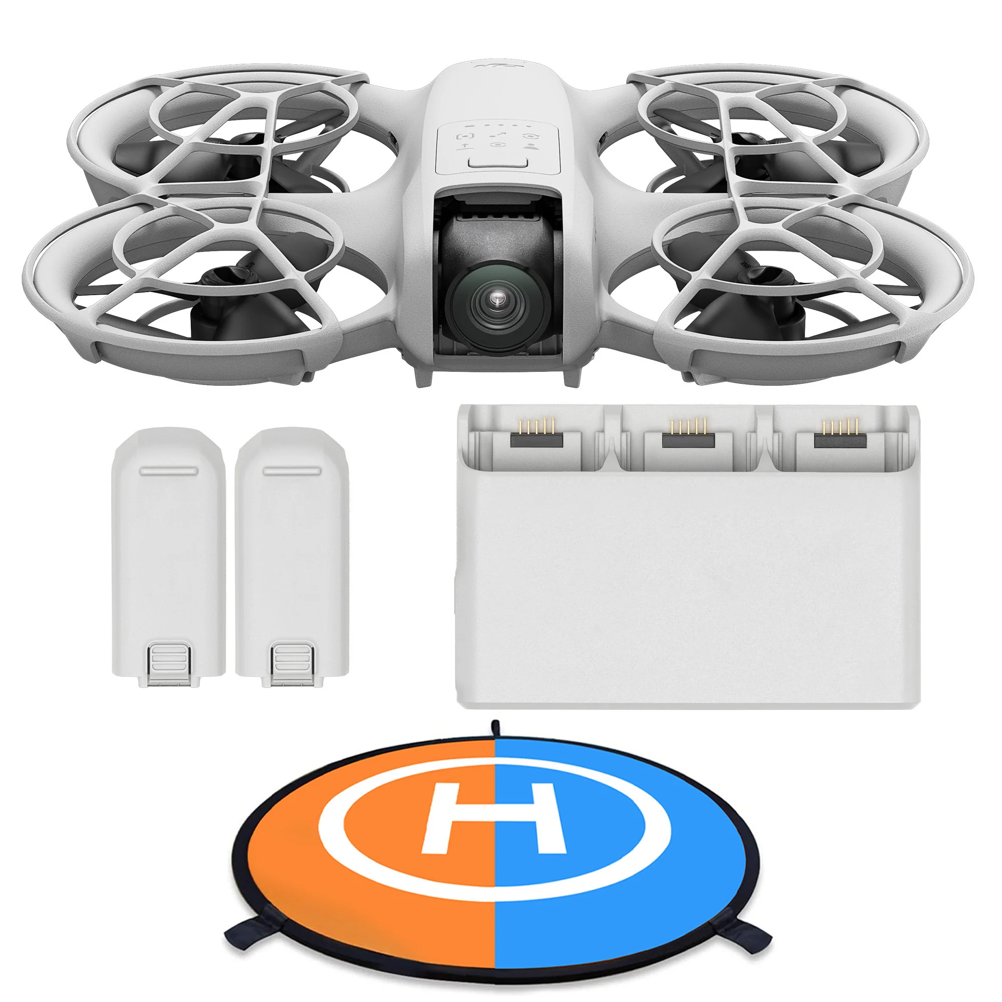
Compatibility with Matrice 350 Plus DJI RC Plus and Matrice 300 Plus DJI RC Plus
Fully compatible with DJI RC Plus controllers on Matrice 350 and 300 drones, enabling seamless integration with advanced DJI flight platforms.
High-Precision Aerial LiDAR System
Integrates frame-based LiDAR, a self-developed high-accuracy IMU system, and a 4/3 CMOS RGB mapping camera for precise, efficient, and reliable geospatial data acquisition.
Integrated LiDAR Solution
Supports on-site preview, playback, and processing of point cloud models, with Task Quality Reports from DJI Terra, offering a one-stop solution for high-precision 3D data collection.
Frame-Based LiDAR
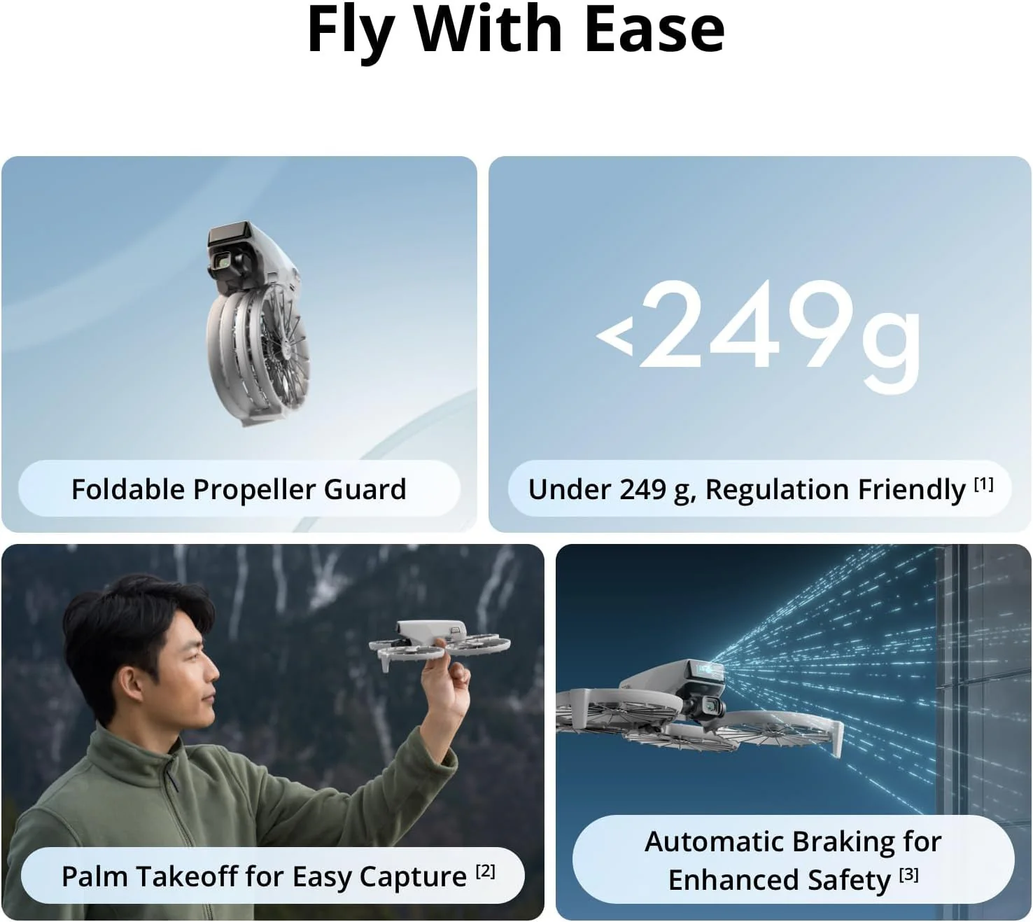
Enhances detection range and data quality, enabling operations at higher altitudes while maintaining safety and efficiency.
Powerful Range and Elevated Precision
Detects objects up to 250m at 10 percent reflectivity and up to 450m at 50 percent reflectivity, with a typical operational altitude of up to 120m.
Smaller Laser Spots, Denser Point Clouds
With a reduced spot size of 4×12 cm at 100m, L2 captures smaller objects with more detail, penetrates denser vegetation, and generates accurate digital elevation models (DEM).
Supports 5 Returns
Captures more ground points beneath foliage, ideal for densely vegetated areas.
Effective Point Cloud Rate: 240,000 pts/s
Achieves a maximum emission rate of 240,000 points per second, allowing faster and denser point cloud acquisition.
Two Scanning Modes
- Repetitive Mode: Produces uniform, accurate point clouds for high-precision mapping.
- Non-Repetitive Mode: Deeper penetration to capture structural information, suitable for power line inspection, forestry, and complex surveying tasks.
Frame-Based Design with Three-Axis Gimbal
Provides an effective point cloud data rate of up to 100 percent and adds flexibility for diverse surveying scenarios.
Enterprise Care Plus
Offers comprehensive coverage equivalent to the product’s value, allowing unlimited free repairs within one year after activation for accidental damages, collisions, water exposure, and operator errors.
More Images


DJI Zenmuse L2 with DJI Care Enterprise Plus High-Precision Aerial LiDAR System
The DJI Zenmuse L2 is a high-precision aerial LiDAR system designed for fast, reliable, and accurate geospatial data collection. It combines a frame-based LiDAR, a self-developed high-accuracy IMU system, and an integrated 4/3 CMOS RGB mapping camera, providing superior performance for DJI flight platforms. Optimized for use with DJI Terra, the Zenmuse L2 delivers a complete solution for 3D data acquisition and high-accuracy post-processing. Ideal for professional mapping and surveying applications, this system ensures efficiency, precision, and reliability in every flight. DJI Enterprise Care Plus offers comprehensive protection against accidental damage, including collisions, water exposure, and misoperation.
Compatibility with Matrice 350 Plus DJI RC Plus and Matrice 300 Plus DJI RC Plus
Fully compatible with DJI RC Plus controllers on Matrice 350 and 300 drones, enabling seamless integration with advanced DJI flight platforms.
High-Precision Aerial LiDAR System
Integrates frame-based LiDAR, a self-developed high-accuracy IMU system, and a 4/3 CMOS RGB mapping camera for precise, efficient, and reliable geospatial data acquisition.
Integrated LiDAR Solution
Supports on-site preview, playback, and processing of point cloud models, with Task Quality Reports from DJI Terra, offering a one-stop solution for high-precision 3D data collection.
Frame-Based LiDAR
Enhances detection range and data quality, enabling operations at higher altitudes while maintaining safety and efficiency.
Powerful Range and Elevated Precision
Detects objects up to 250m at 10 percent reflectivity and up to 450m at 50 percent reflectivity, with a typical operational altitude of up to 120m.
Smaller Laser Spots, Denser Point Clouds
With a reduced spot size of 4×12 cm at 100m, L2 captures smaller objects with more detail, penetrates denser vegetation, and generates accurate digital elevation models (DEM).
Supports 5 Returns
Captures more ground points beneath foliage, ideal for densely vegetated areas.
Effective Point Cloud Rate: 240,000 pts/s
Achieves a maximum emission rate of 240,000 points per second, allowing faster and denser point cloud acquisition.
Two Scanning Modes
- Repetitive Mode: Produces uniform, accurate point clouds for high-precision mapping.
- Non-Repetitive Mode: Deeper penetration to capture structural information, suitable for power line inspection, forestry, and complex surveying tasks.
Frame-Based Design with Three-Axis Gimbal
Provides an effective point cloud data rate of up to 100 percent and adds flexibility for diverse surveying scenarios.
Enterprise Care Plus
Offers comprehensive coverage equivalent to the product’s value, allowing unlimited free repairs within one year after activation for accidental damages, collisions, water exposure, and operator errors.
Product Information
Product Information
Shipping & Returns
Shipping & Returns
Description
The DJI Zenmuse L2 is a high-precision aerial LiDAR system designed for fast, reliable, and accurate geospatial data collection. It combines a frame-based LiDAR, a self-developed high-accuracy IMU system, and an integrated 4/3 CMOS RGB mapping camera, providing superior performance for DJI flight platforms. Optimized for use with DJI Terra, the Zenmuse L2 delivers a complete solution for 3D data acquisition and high-accuracy post-processing. Ideal for professional mapping and surveying applications, this system ensures efficiency, precision, and reliability in every flight. DJI Enterprise Care Plus offers comprehensive protection against accidental damage, including collisions, water exposure, and misoperation.
Compatibility with Matrice 350 Plus DJI RC Plus and Matrice 300 Plus DJI RC Plus
Fully compatible with DJI RC Plus controllers on Matrice 350 and 300 drones, enabling seamless integration with advanced DJI flight platforms.
High-Precision Aerial LiDAR System
Integrates frame-based LiDAR, a self-developed high-accuracy IMU system, and a 4/3 CMOS RGB mapping camera for precise, efficient, and reliable geospatial data acquisition.
Integrated LiDAR Solution
Supports on-site preview, playback, and processing of point cloud models, with Task Quality Reports from DJI Terra, offering a one-stop solution for high-precision 3D data collection.
Frame-Based LiDAR
Enhances detection range and data quality, enabling operations at higher altitudes while maintaining safety and efficiency.
Powerful Range and Elevated Precision
Detects objects up to 250m at 10 percent reflectivity and up to 450m at 50 percent reflectivity, with a typical operational altitude of up to 120m.
Smaller Laser Spots, Denser Point Clouds
With a reduced spot size of 4×12 cm at 100m, L2 captures smaller objects with more detail, penetrates denser vegetation, and generates accurate digital elevation models (DEM).
Supports 5 Returns
Captures more ground points beneath foliage, ideal for densely vegetated areas.
Effective Point Cloud Rate: 240,000 pts/s
Achieves a maximum emission rate of 240,000 points per second, allowing faster and denser point cloud acquisition.
Two Scanning Modes
- Repetitive Mode: Produces uniform, accurate point clouds for high-precision mapping.
- Non-Repetitive Mode: Deeper penetration to capture structural information, suitable for power line inspection, forestry, and complex surveying tasks.
Frame-Based Design with Three-Axis Gimbal
Provides an effective point cloud data rate of up to 100 percent and adds flexibility for diverse surveying scenarios.
Enterprise Care Plus
Offers comprehensive coverage equivalent to the product’s value, allowing unlimited free repairs within one year after activation for accidental damages, collisions, water exposure, and operator errors.